Real terrain, raised off the wall
3D topographic maps of real places, built from USGS elevation data and finished by hand in Salt Lake City.
Free US shipping. Ships ready to hang.
The maps
Every map comes in 7 or 9 inches square, with a marble finish plaque showing the real coordinates.

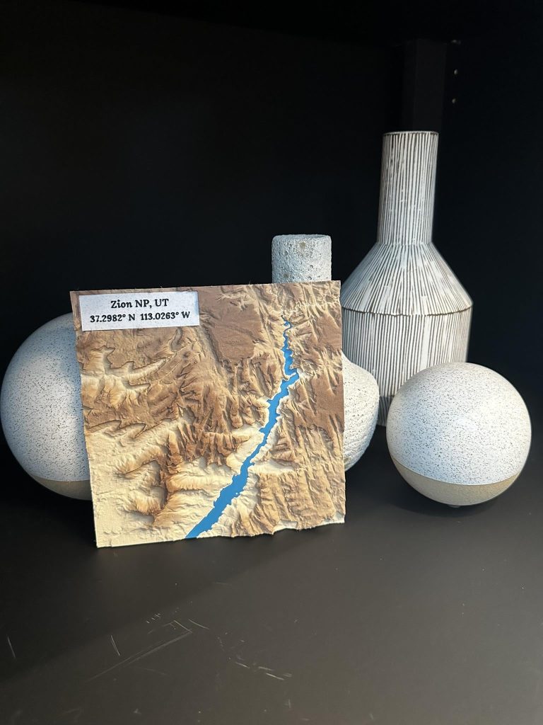
Zion National Park
The Virgin River winding through the canyon, every cliff and side canyon where it really is.
From $95

Kings Peak
Utah’s highest summit and the alpine lakes of the Uinta Mountains around it.
From $95
Don’t see your place?
I can map anywhere in the United States: a cabin, a trail, a hometown, the lake you grew up on.
You see a preview before anything prints.
From $115
Watch the light move
Drag across the map to move the sun over Zion Canyon. It’s built from the same USGS elevation data as the Zion print, with the Virgin River in blue.
The same thing happens on a wall. Morning light picks out one side of every ridge and evening light the other, so the piece never looks quite the same twice.
8:30 am

How custom maps work
- Order on Etsy and tell me the place: a name, a Google Maps pin or coordinates.
- I build your map from the elevation data and send you a preview.
- Ask for changes until it looks right. Nothing prints until you say yes.
Why they’re different
Real survey data
Every map starts with USGS elevation data. Ridges, canyons and river bends sit exactly where they do in real life, so if you know a place, you’ll find your spots on it.
Ready to hang
A keyhole mount is built into the back, and the screw, wall anchor and hanging instructions are in the box.
One of one
Printed in a stone filled filament that shifts in tone as it prints, so the color lands differently on every piece. No two come out the same.
Made to give
The peak they finally summited, the canyon from the trip they still talk about. A map of a place that matters says more than most gifts can.
Made by one person
Terra Forma Maps is me, one person in a small studio in Salt Lake City. I build every model from the elevation data, print it, check it by hand and pack it myself. Nothing is drop shipped, and nothing comes out of a factory.
